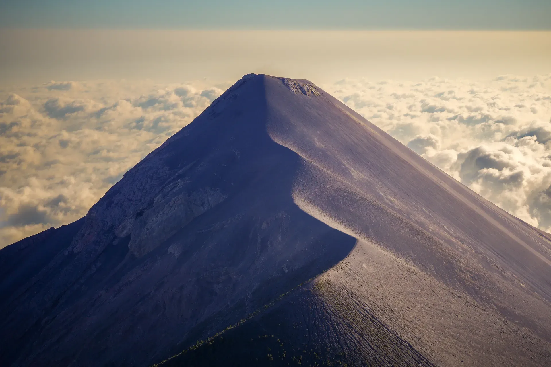
Acatenango Volcano rises 3,976 meters above Guatemala, directly facing the highly active Volcán de Fuego. Climbers ascend through four distinct microclimates to watch glowing lava erupt from Fuego's crater every 15 to 30 minutes.
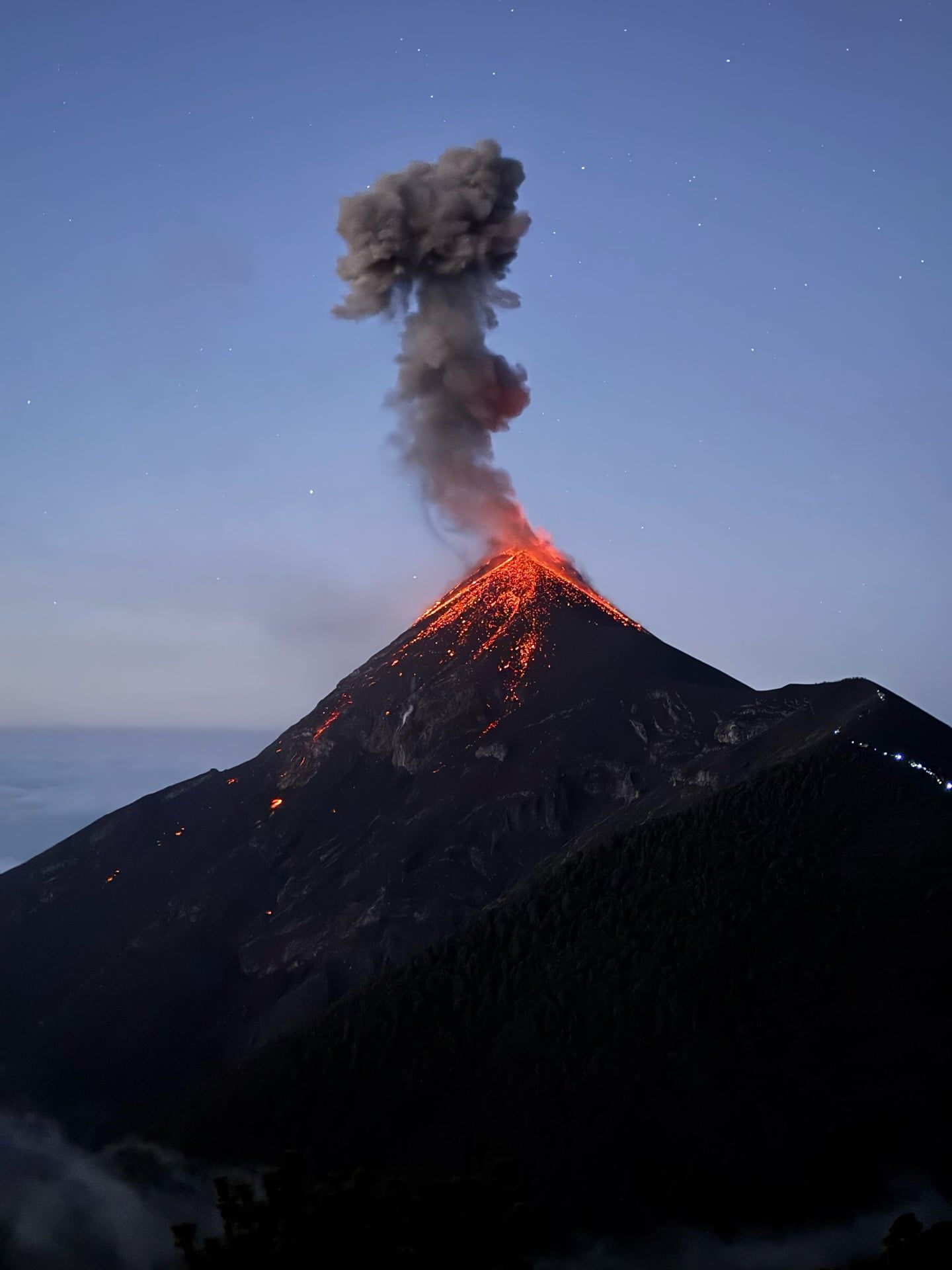
Acatenango Volcano rises 3,976 meters above Guatemala's Sierra Madre mountain range, directly facing the highly active Volcán de Fuego. The two peaks join to form a massive volcanic complex known as La Horqueta. Climbers tackle a 1,500-meter vertical ascent to reach a high-altitude base camp at 3,600 meters. From this vantage point, glowing orange lava and pyroclastic material shoot into the night sky from Fuego's crater just three kilometers away. The eruptions occur every 15 to 30 minutes. Deep, rumbling explosions shake the ground beneath the wooden A-frame cabins.
The standard overnight trek requires 24 hours to complete. Hikers push through four distinct ecological zones on the mountain's slopes. The trail starts in low-altitude agricultural farmlands. It transitions into dense cloud forests filled with wildlife, crosses tropical alpine forests, and finishes in barren volcanic rock. Temperatures at the summit drop to -5°C with severe wind chill. The extreme physical difficulty and freezing high-altitude winds mean this climb demands proper gear, including thermal base layers, down jackets, and windproof shells.
Heavy rainfall between May and October turns the steep volcanic sand into a muddy, slippery hazard. Dense cloud cover during these months frequently blocks all visibility of Fuego's eruptions. November through April provides the most stable weather and clearest skies for night viewing. Visitors must pay a Q100 entrance fee in cash at the La Soledad trailhead and hire a certified guide to legally access the mountain.
The rugged terrain lacks paved trails, ramps, or facilities, making it completely inaccessible for wheelchairs. The extreme altitude and steep inclines also make the standard hike unsuitable for older adults and young children. Tour operators strictly prohibit children under five years old from joining the trek. Kids aged six to twelve must sleep in private cabins with a parent, as the base camps feature steep, unfenced edges that pose a severe fall hazard. Some agencies offer a private 4x4 tour option that drives visitors up a private road, reducing the journey to a short, one-hour walk to base camp. Most climbers arrive via a one-hour shuttle ride from Antigua, covering 30 kilometers to reach the trailhead before 9:00 AM.
The evolutionary history of the Fuego-Acatenango complex spans over 84,000 years. Volcanic activity first shaped the region during the Pleistocene epoch, driven by the subduction of the Cocos Plate beneath the Caribbean Plate. An older volcanic edifice collapsed prior to 43,000 years ago, triggering the massive La Democracia debris-avalanche. This catastrophic event reshaped the surrounding landscape, depositing massive amounts of rock and soil across the Pacific coastal plain. The collapse laid the foundation for the modern volcanic structures. Magma continued to push upward through the weakened crust, slowly building the twin peaks that dominate the skyline today.
Yepocapa, the northern peak standing at 3,880 meters, finished forming around 20,000 years ago. Geologists date the oldest rocks found on the volcano to approximately 200,000 years, indicating a long, complex eruptive history. Following Yepocapa's completion, volcanic activity shifted southward to develop Pico Mayor, the 3,976-meter main summit. This southern peak, also known as El Plato, grew through thousands of years of steady ash and lava accumulation. The complex remained relatively quiet for long stretches. Dense forests took root on its slopes and wildlife populated the lower elevations.
Historical records of Acatenango's eruptions are sparse compared to its volatile neighbor, Fuego. The first well-documented historical eruptions occurred between 1924 and 1927. These explosive events broke a long period of dormancy. Ash plumes drifted over the nearby colonial city of Antigua, forcing residents to sweep their roofs daily. Acatenango erupted again in November 1972. This final recorded event ejected volcanic bombs and covered a 25-kilometer radius with a thick layer of fine ash. The eruption lasted through December before the volcano returned to a dormant state.
Today, Acatenango remains quiet. It acts as a stable platform for observing Fuego's constant activity. The mountain transitioned from a geological giant into a major destination for high-altitude mountaineering in the late 20th century. Local municipalities of Acatenango and Alotenango now manage access to the trails, collecting fees to maintain the routes. Guides from nearby villages lead thousands of climbers up the steep slopes each year. Tour operators in Antigua require hikers to leave a government ID, driver's license, passport, or a $100 cash deposit to rent essential cold-weather gear before leaving the city.
Two distinct summits define the 3,976-meter profile of Acatenango Volcano. The northern peak, Yepocapa, reaches 3,880 meters, while the main southern summit, Pico Mayor, forms a massive crater known as El Plato. A high-altitude saddle connects Acatenango directly to Volcán de Fuego, creating a continuous three-kilometer ridge of volcanic rock between the two peaks. This saddle drops down to around 3,200 meters before rising sharply again toward Fuego's active cone.
The mountain's surface changes drastically across 1,500 vertical meters of elevation gain. The base consists of loose volcanic sand and active agricultural plots where local farmers grow corn and beans. Above 2,500 meters, the terrain shifts into a dense cloud forest where thick canopy cover traps moisture. The trail here consists of deep, muddy ruts carved by heavy foot traffic and rainfall. Old-growth trees covered in moss and epiphytes line the steep switchbacks. Higher up, tropical alpine forests feature hardy pine trees that gradually thin out as the elevation increases and the air grows thinner.
The final 400 meters to the summit consist entirely of barren volcanic scree. Hikers navigate steep inclines of loose gravel and slippery ash that offer little traction. High-altitude winds whip across this exposed rock, dropping temperatures to -5°C. At 3,600 meters, operators have cut flat terraces into the mountainside to build A-frame wooden cabins. These structures feature large windows facing south, allowing climbers to watch Fuego's pyroclastic flows from their sleeping mats. The cabins provide crucial shelter from the freezing winds, though they lack electricity, heating, or running water.
The mountain lacks developed restrooms, showers, or changing rooms. The only facilities available are basic drop latrines located at the established base camps. Hikers must pack in all their drinking water, with operators recommending at least four liters per person. Constant eruptions from neighboring Fuego kick up clouds of fine volcanic dust and ash along the trail, causing respiratory irritation. Climbers wear face buffs or gaiters to protect their lungs and keep camera gear in sealed, dust-resistant bags. The descent requires sturdy hiking boots with deep tread to prevent severe ankle injuries on the shifting gravel.
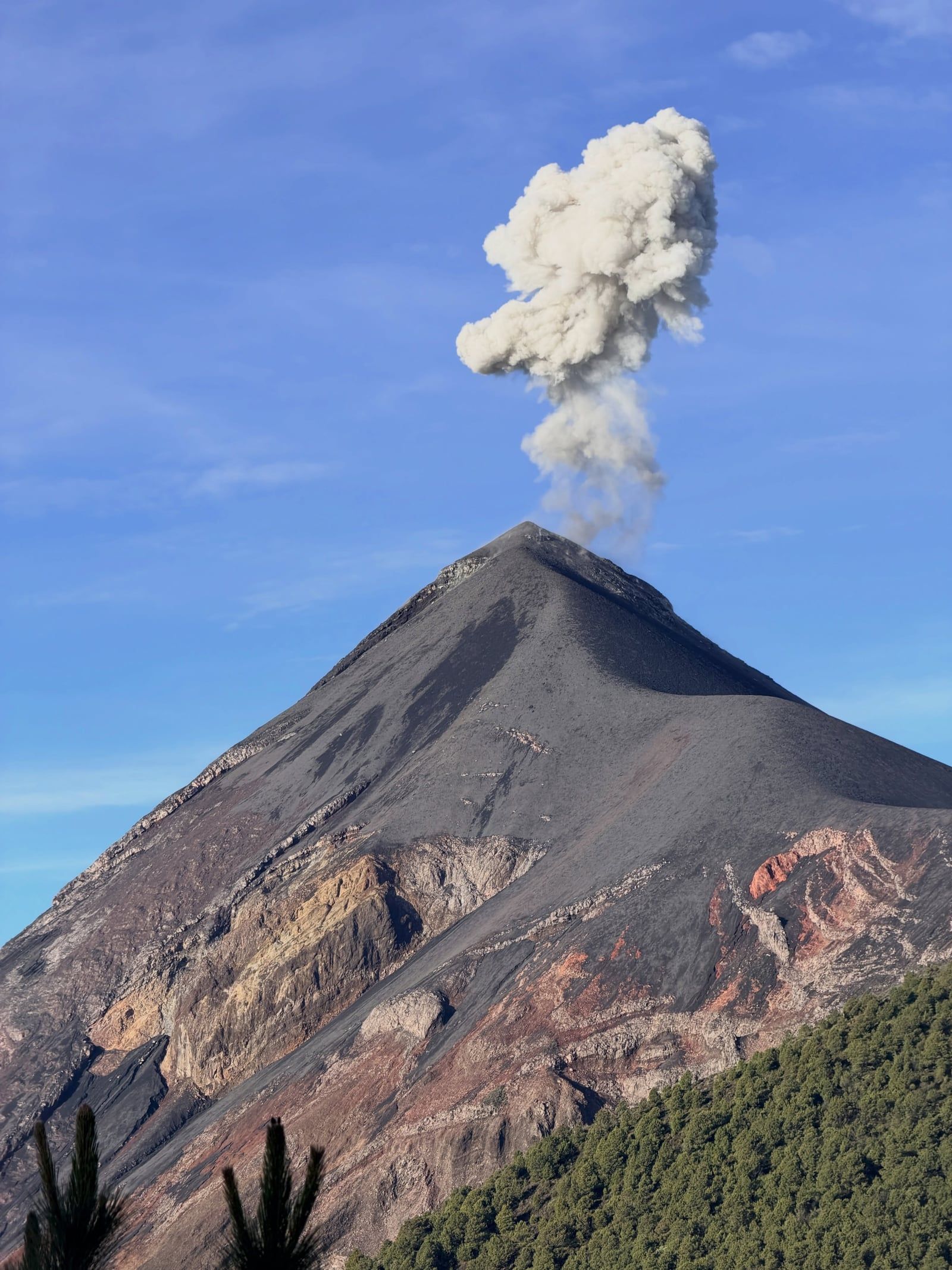
Acatenango and Fuego hold deep roots in ancient Maya mythology. Local legends identify the two peaks as the 'Twin Brothers' Hunahpú and Ixbalanqué. These figures from the Popol Vuh represent the Moon and the Sun, locked in a perpetual cycle of death and rebirth. The dormant Acatenango stands as the quiet, observing brother, while Fuego acts as the fiery, active counterpart. Indigenous communities surrounding the mountains have navigated this dual nature for centuries. They farm the fertile volcanic soil at the base, relying on the mineral-rich ash to grow crops, while respecting the destructive power looming above.
The volcano dictates the daily economic rhythm of nearby villages like La Soledad. Local residents work as certified guides and porters, carrying heavy supplies up the 1,500-meter ascent. Porters charge between Q150 and Q200 each way to transport 30-liter backpacks to base camp. This physical labor provides a crucial income stream for families in the region, shifting the local economy from purely agricultural to tourism-dependent. All payments at the trailhead supply center, including entrance fees, porter hires, and walking stick rentals, occur entirely in cash. Local hawkers gather at the trailhead every morning, selling hand-carved wooden walking sticks for Q5 to Q10 to climbers preparing to face the steep volcanic sand.
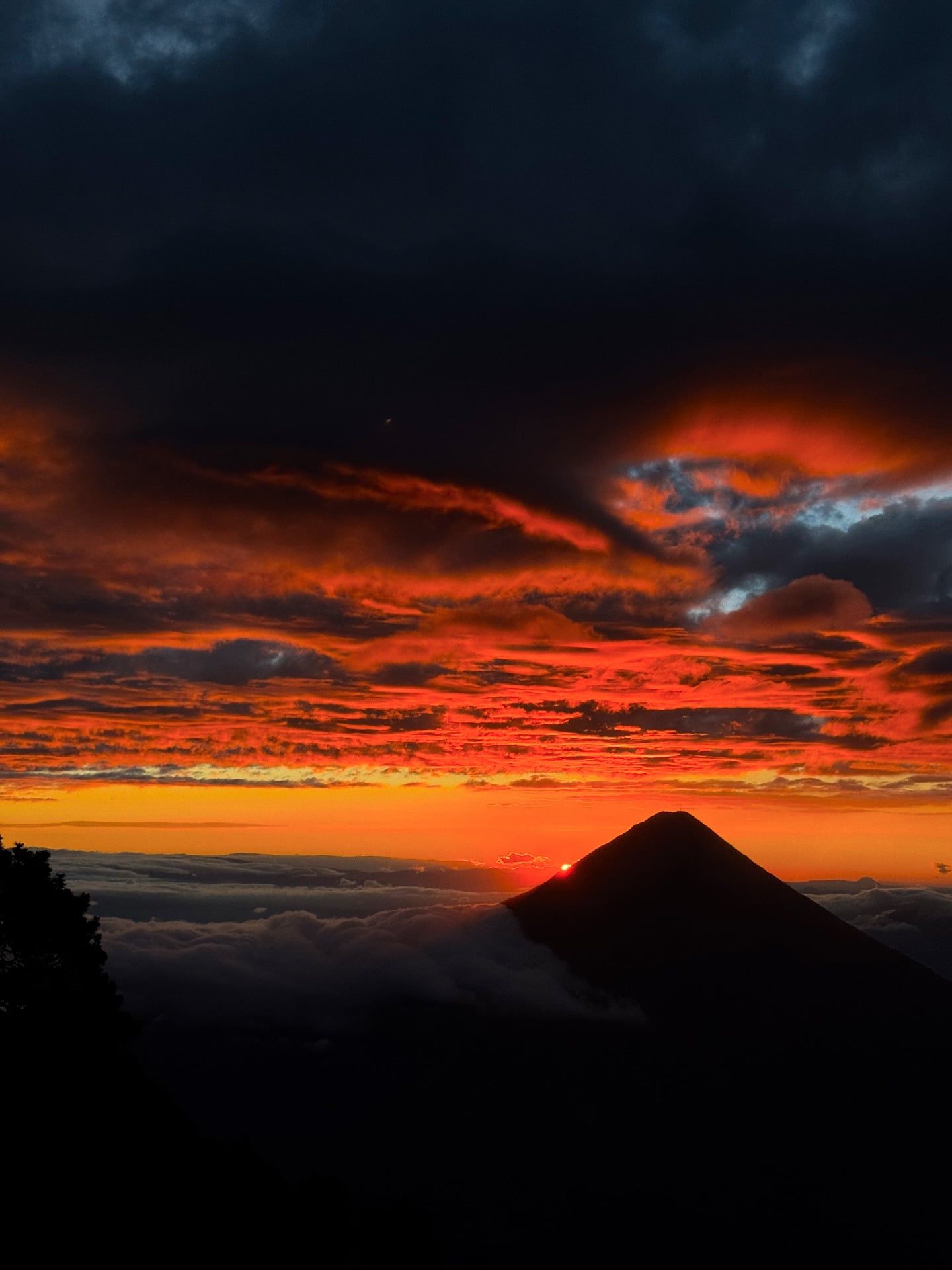
Mountaineers globally recognize the peak as ranking among the top 20 sunrise viewpoints in the world. The grueling physical challenge draws thousands of climbers to Antigua each year. Upon reaching the summit of Pico Mayor, hikers can take on the unique crater run challenge offered by OX Expeditions. Participants attempt to sprint around the volcano's massive crater rim at nearly 4,000 meters of elevation. Pushing their physical limits in the thin air, successful runners win a free commemorative t-shirt. The mountain acts as a proving ground for climbers preparing for larger peaks in the Andes or Himalayas. Visitors spend at least one or two nights in Antigua at 1,500 meters to acclimatize before tackling the extreme vertical gain.
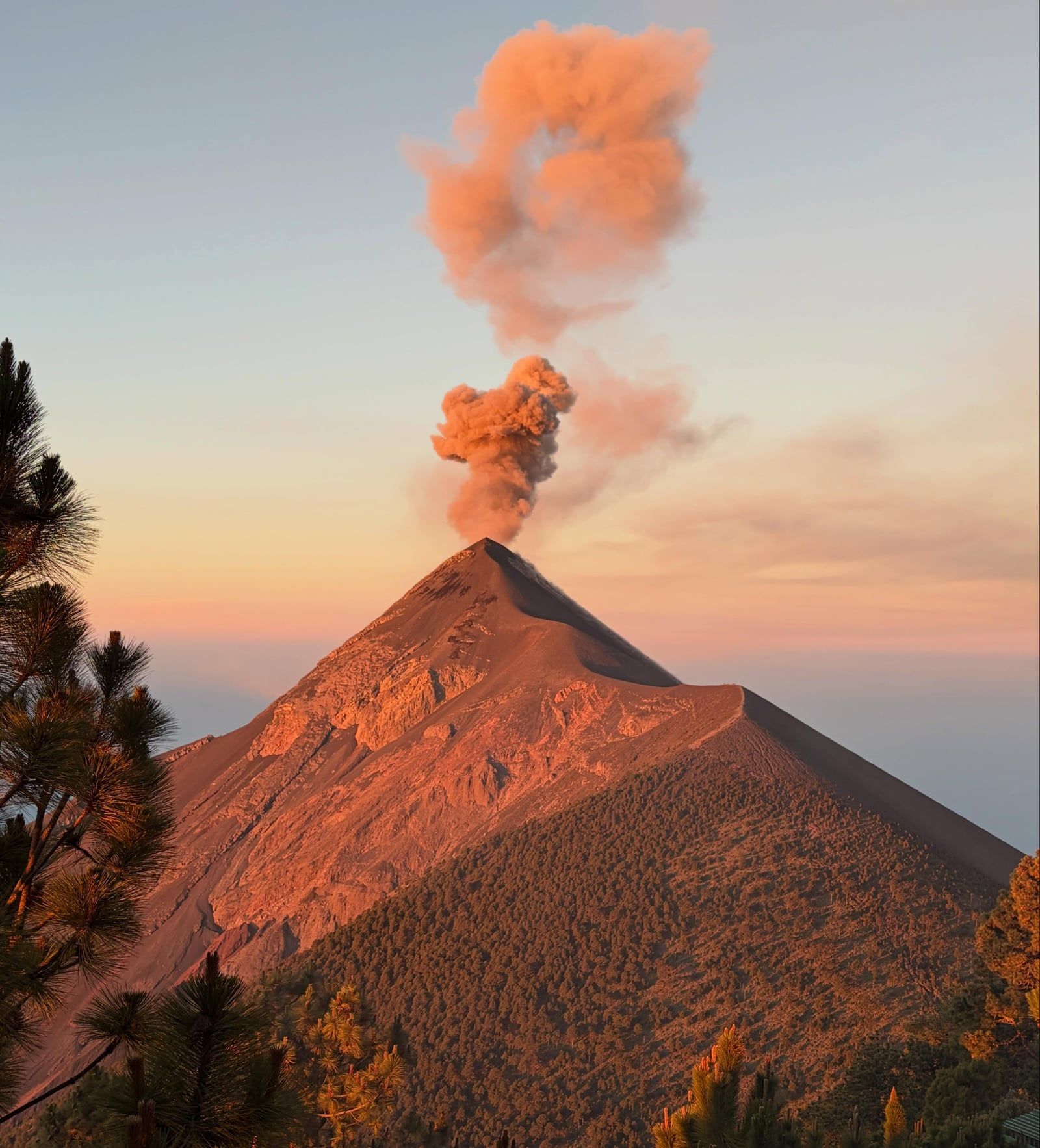
Acatenango and Fuego are collectively known as La Horqueta, forming a massive twin-volcano complex.
Hikers can attempt a high-speed crater run around Pico Mayor's rim to win a commemorative t-shirt.
Summit temperatures routinely drop to -5°C (23°F), requiring heavy down jackets in a tropical country.
The oldest volcanic rocks found on Acatenango's slopes date back approximately 200,000 years.
Base camps sit at 3,600 meters, placing climbers exactly at eye level with Fuego's erupting crater.
The mountain's 1972 eruption covered a 25-kilometer radius with a thick layer of fine volcanic ash.
A specialized extension trail brings adventurous hikers within 200 meters of Fuego's active drop zone.
Acatenango stands at an elevation of 3,976 meters (13,045 feet) above sea level. It ranks as the third-highest volcano in Guatemala and features a prominence of 1,835 meters.
Acatenango is currently dormant. Its last historical eruption occurred in December 1972, ejecting volcanic bombs and ash, but it is now considered safe for guided tourism.
Foreign tourists pay a total of Q100 (approximately $13 USD) in cash at the La Soledad trailhead. This covers a Q50 Acatenango municipality fee and a Q50 Alotenango camping area fee.
The ascent to base camp requires 5 to 9 hours of steep climbing. Reaching the summit takes an additional 50 minutes the next morning, followed by a 2 to 3-hour descent.
Certified guides are mandatory under CONRED and INGUAT regulations. Independent hiking is prohibited to ensure safety on the unstable terrain and to manage emergency responses.
Temperatures at the 3,976-meter summit drop to -5°C (23°F) with severe wind chill. Climbers must pack thermal base layers, fleece mid-layers, and windproof shells to prevent hypothermia.
The mountain has no natural water sources or potable taps. Tour operators require hikers to carry at least 4 liters of water per person for the 24-hour expedition.
Local porters wait at the La Soledad trailhead to carry backpacks up the volcano. They charge between Q150 and Q200 (approximately $20 to $26 USD) each way, payable only in cash.
The Fuego extension is an optional, highly strenuous trek across the saddle connecting the two volcanoes. It costs an additional Q200 to Q250 and brings climbers within 200 meters of Fuego's active crater.
The mountain lacks developed restrooms, showers, or running water. Base camps provide only basic drop latrines, requiring hikers to pack their own toilet paper and hand sanitizer.
Browse verified tours with free cancellation and instant confirmation.
Find Tours