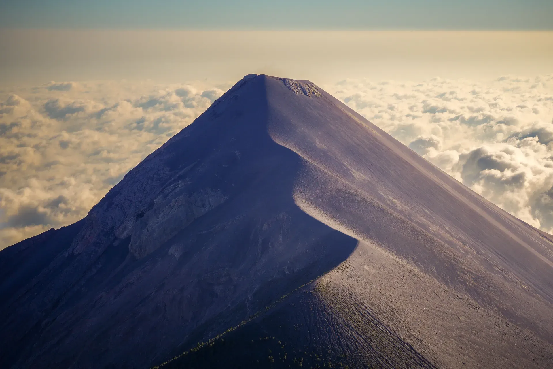
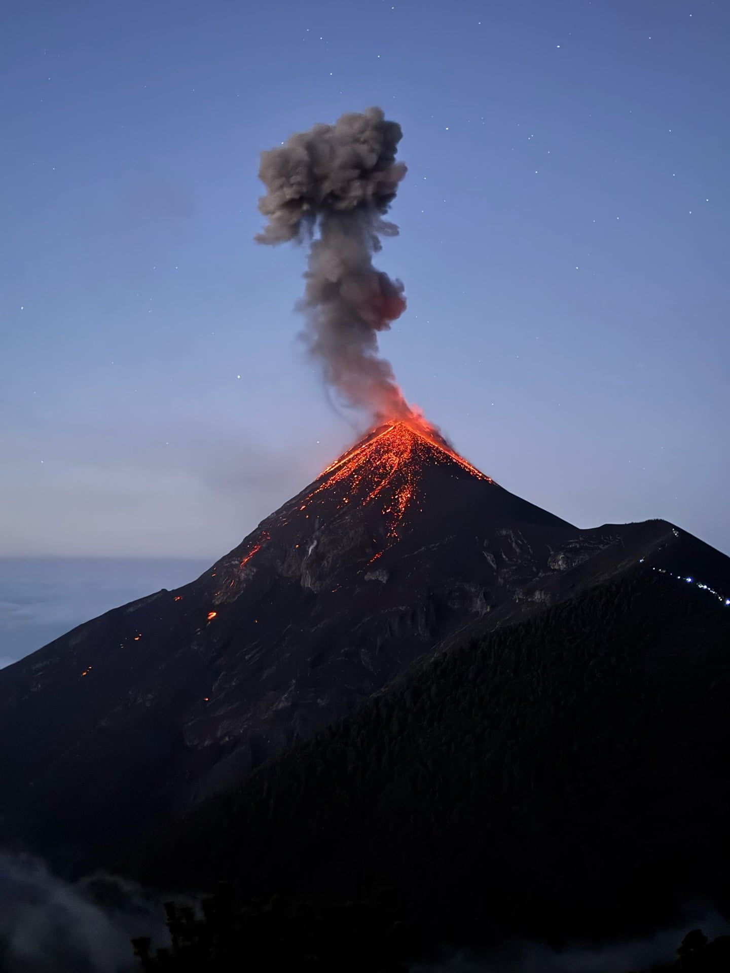
Rising 3,976 meters above sea level, Acatenango Volcano provides a direct vantage point of Volcán de Fuego's active eruptions just three kilometers away. From the 3,600-meter base camp, climbers can watch glowing orange lava and ash shoot into the night sky every 15 to 30 minutes.
Find Guided ToursAcatenango is a massive composite stratovolcano located in Guatemala, situated just 15 kilometers southwest of the historic city of Antigua. Rising to an elevation of 3,976 meters (13,045 feet) with a prominence of 1,835 meters, it stands as the third-highest peak in the country. The mountain forms part of the Sierra Madre range and the broader Central America Volcanic Arc.
The volcano features two distinct summits: the northern Yepocapa peak at 3,880 meters and the main southern summit known as Pico Mayor. It is physically joined with the highly active Volcán de Fuego, located just three kilometers to the south across a saddle. Together, they form a volcanic complex known as La Horqueta. This proximity allows climbers on Acatenango to safely observe Fuego's frequent eruptions from a high-altitude vantage point, earning the mountain a reputation as one of the top 20 sunrise viewpoints in the world.
The evolutionary history of the Fuego-Acatenango complex spans tens of thousands of years, dating back to approximately 84,000 BCE. Prior to 43,000 years ago, an older volcanic edifice collapsed, creating the La Democracia debris-avalanche. The northern Yepocapa peak finished forming around 20,000 years ago, followed by the gradual development of Pico Mayor. Today, climbers ascending the slopes pass through four distinct ecological zones, starting in low-altitude agricultural farmlands and progressing through cloud forests and tropical alpine environments before reaching barren volcanic rock.
Acatenango holds deep cultural roots in the region. According to ancient Maya legend, Acatenango and Fuego represent the 'Twin Brothers' Hunahpú and Ixbalanqué, symbolizing the Moon and the Sun. While Fuego remains highly active, Acatenango is currently dormant. Its first well-documented historical eruptions occurred between 1924 and 1927. The volcano last erupted between November and December 1972, ejecting volcanic bombs and covering a 25-kilometer radius with ash.
Discover the full history and cultural significance on our About page.
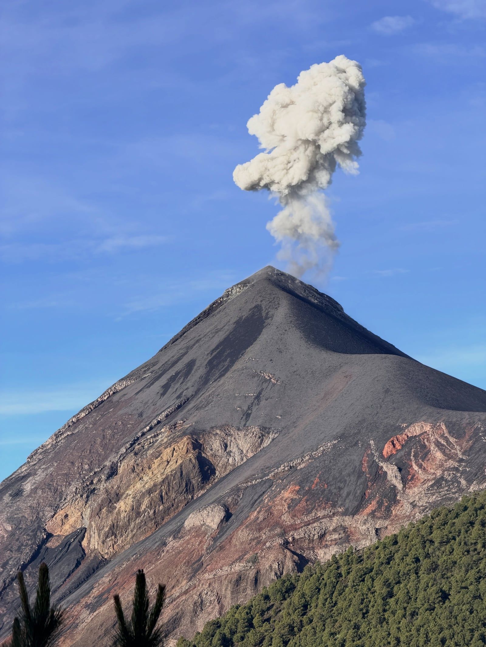
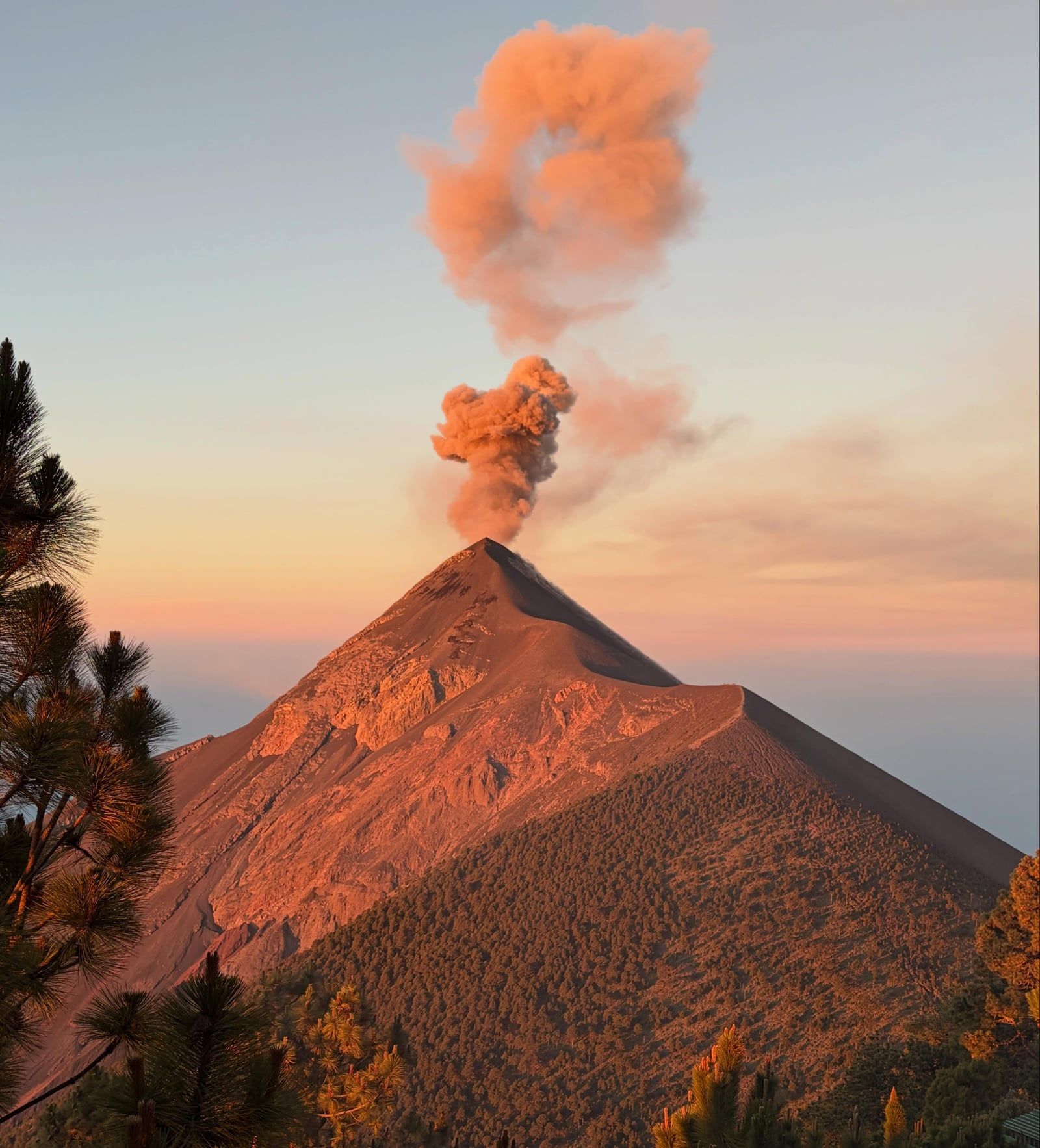
From the 3,600-meter base camp, hikers have a direct view of the highly active Volcán de Fuego. Every 15 to 30 minutes, deep explosions send glowing orange lava and pyroclastic material shooting into the dark sky. You can safely watch this display from your sleeping mat.
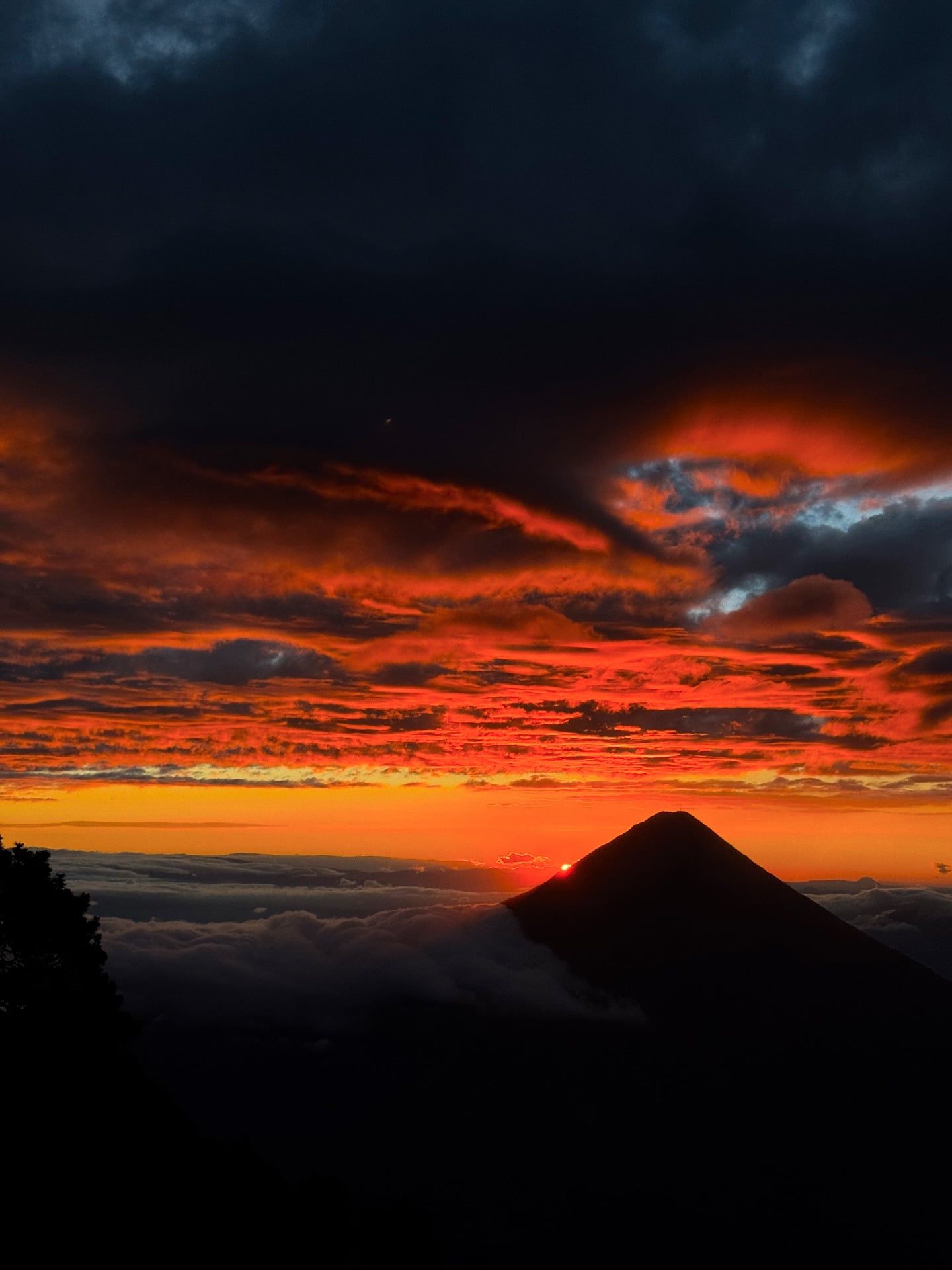
A freezing 50-minute early morning climb brings you to the 3,976-meter summit of Pico Mayor. As light breaks over a vast sea of clouds, the peak provides panoramic views across the landscape. You can clearly see neighboring volcanic peaks and the distant waters of Lake Atitlán.
The 1,500-meter vertical ascent passes through four entirely different microclimates. Hikers start in low-altitude agricultural farmlands before moving into wildlife-filled cloud forests. The trail then transitions into tropical alpine forests and finally ends in a harsh landscape of barren volcanic rock near the summit.
Advanced trekkers can pay an extra fee to cross the saddle connecting the two volcanoes. This challenging extension trail leads to a vantage point just 200 meters below Fuego's active crater. It allows climbers to feel the raw, vibrating power of the eruptions at close range.
Hand-picked tours with free cancellation and verified reviews
 48h
48h  Free Cancellation 48h
  48h
48h  Free Cancellation 48h
  Free Cancellation 48h
  New 48h
  Free Cancellation 48h
  48h
48h The optimal time to hike Acatenango Volcano is during the dry season from November to April. These months provide the most stable weather and clear skies necessary for viewing Volcán de Fuego's eruptions, though summit temperatures can drop to -5°C.
March and April provide excellent dry-season hiking conditions with clear visibility. However, May marks the beginning of the rainy season, bringing heavy precipitation and muddy trails that complicate the 1,500-meter climb.
These months fall squarely in the rainy season. Heavy rainfall creates slippery, unstable trail conditions, while dense cloud cover frequently blocks the views of neighboring Volcán de Fuego entirely.
September and October bring continued heavy rain and poor visibility. Conditions improve significantly in November as the dry season begins, clearing the skies for nighttime viewing of Fuego's lava flows.
Falling entirely within the dry season, these months offer the clearest skies and optimal visibility for watching Fuego's eruptions. Hikers must prepare for severe wind chill and -5°C summit temperatures.
Acatenango Volcano is open 24 hours a day.
| Category | Price |
|---|---|
| Foreigners | Q100 (approximately USD 13) |
| Guatemalans | Q50 |
| Students with valid ID | Q35 |
| Acateco tourists | Free |
Park entrance fees must be paid in cash at the La Soledad trailhead. The total fee for Guatemalans and students is split between the Acatenango municipality and the Alotenango camping area. Certified guides are mandatory for all hikers under CONRED and INGUAT regulations.
For complete schedules and ticket prices, visit our Hours & Fees page.
Acatenango Volcano is located 30 kilometers by road from Antigua Guatemala, with the main trailhead situated in Aldea La Soledad. Visitors typically reach the starting point via pre-arranged tour shuttles, private taxis, or local buses.
📍 Aldea La Soledad, Guatemala
Most visitors reach the volcano using transportation provided by their guiding agency. Operators typically pick up hikers directly from hotels in Antigua Guatemala between 8:00 AM and 9:00 AM. These private group shuttles drive 30 kilometers straight to the main trailhead in La Soledad. This transport is already factored into the standard tour price.
Hiring a private taxi or Uber from Antigua provides a direct 30-kilometer ride to the La Soledad trailhead. The drive takes about one hour under normal traffic conditions. Finding an Uber for the return trip is highly difficult due to the remote location. Hikers choosing this method should arrange their return pickup with the driver beforehand.
The local public transit system offers the cheapest route from Antigua Guatemala to the mountain. Passengers board a bus at the Antigua terminal heading to Parramos. From Parramos, riders must transfer to a second bus or microbus bound for Yepocapa. You will need to ask the driver to stop at La Soledad, though the route can be confusing for first-time riders.
Driving from Guatemala City takes under two hours depending on traffic. Motorists head west on the CA-1 Occidente highway toward Chimaltenango. After turning onto the CA-1 Occidente-Libramiento de Chimaltenango, drivers take the Carretera a Parramos. The route continues through Parramos and turns right onto Ruta a Yepocapa, ending at Aldea La Soledad where parking is available.
For detailed transport options and routes, visit our Directions page.
All payments at the La Soledad trailhead supply center require cash. You need Guatemalan Quetzales for the Q100 foreigner entrance fee, Q150 to Q200 for a porter, and Q5 to Q10 for a walking stick. Credit cards are rarely accepted and often carry a 10% surcharge.
The climb from 1,500 meters to nearly 4,000 meters can trigger acute altitude sickness. Spend at least one or two nights in Antigua Guatemala before starting the trek. This allows your body to adjust to the elevation, significantly reducing the risk of headaches and nausea on the mountain.
Local vendors at the trailhead sell wooden walking sticks for Q5 to Q10. Renting one is highly recommended for navigating the terrain. The path features steep inclines covered in loose volcanic sand and scree, making the stick essential for maintaining traction and stability during both the ascent and descent.
Constant eruptions from Volcán de Fuego and descending hikers kick up thick clouds of fine volcanic dust. Wearing a face buff or gaiter protects your lungs and makes breathing easier during the steep climb. Photographers should also bring sealed, dust-resistant bags to protect their camera equipment.
Standard running shoes or sneakers are insufficient for this environment. The trail consists of loose gravel and highly slippery ash. You must wear sturdy hiking boots with deep tread and strong ankle support to prevent painful injuries, especially during the steep and unstable descent.
Summit temperatures frequently drop to -5°C (23°F) with severe wind chill. You need a thermal base, fleece, down jacket, windproof shell, gloves, and a warm hat to prevent hypothermia. Since you must carry all gear plus 4 liters of water up 1,500 vertical meters, leave non-essential heavy items in Antigua.
Located just three kilometers south of Acatenango, Fuego stands out as one of Central America's most active volcanoes. Hikers watch its dramatic eruptions safely from Acatenango's base camp.
This colonial town serves as the primary hub for local tours and features cobblestone streets and picturesque plazas. Spending time here helps hikers acclimatize to the 1,500-meter altitude.
Pacaya provides an accessible, family-friendly day hike across active lava fields. Visitors enjoy clear views of the lowlands and can even roast marshmallows over natural volcanic heat vents.
Read what travelers share about their experience visiting Acatenango Volcano — from practical tips to personal highlights.


Foreign tourists must pay a Q100 (about $13 USD) entrance fee in cash at the La Soledad trailhead. This covers municipal fees for both Acatenango and Alotenango. You will also need to pay for a mandatory guided tour, which typically ranges from $49 to over $250.
The dry season from November to April offers the most stable weather and clearest skies for viewing Volcán de Fuego's eruptions. Hiking during the May to October rainy season increases the likelihood of dense cloud cover and muddy trails. Prepare for colder summit temperatures and stronger winds during the dry months.
The standard overnight trek takes approximately 24 hours, spanning two days and one night. The initial ascent to the 3,600-meter base camp takes between 5 and 9 hours depending on your fitness level. The final summit push takes about 50 minutes, followed by a 2 to 3-hour descent.
The La Soledad trailhead is located 30 kilometers from Antigua. Most tour operators include a private shuttle that picks you up between 8:00 AM and 9:00 AM for the one-hour drive. Alternatively, you can take an Uber for around 230 GTQ or a two-hour chicken bus ride via Parramos for roughly Q20.
Yes, hiring a certified guide is mandatory under CONRED and INGUAT regulations. Tour agencies handle the logistics, provide necessary cold-weather gear, and ensure safety on the mountain. You will need to leave a government ID or a $100 cash deposit with your agency when renting equipment.
You need multiple warm layers, including a thermal base, fleece, down jacket, and gloves, as summit temperatures can drop to -5°C (23°F) with wind chill. Sturdy hiking boots with ankle support are essential for navigating the steep, loose volcanic sand. You should also bring a face buff to protect your lungs from volcanic dust and 4 liters of drinking water.
The standard 1,500-meter vertical climb is extremely physically demanding and generally not suitable for older adults or young children. Some agencies strictly prohibit children under 5 years old. However, older visitors can book a private 4x4 tour that drives up a private road, reducing the hike to a flat, one-hour walk to base camp.
Local porters are available at the La Soledad trailhead to carry your gear. The service costs between Q150 and Q200 each way. You must pay this fee in cash, so bring plenty of Guatemalan Quetzales since card payments are rarely accepted.
Browse verified tours with free cancellation and instant confirmation.
Find Tours